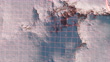
Visualization of a satellite scan of a mountain range. A red scanning line passes through the rocky terrain, mountains and peaks, the satellite analyzes the surface and uses artificial intelligence to make a three-dimensional map of the area. - Vídeo de stock 4K
A bright red line runs along the mountain surface, the satellite analyzes the surface, determines the height of the mountains and with the help of artificial intelligence makes a three-dimensional map of the area.


COMPRAR UMA LICENÇA
Todas as licenças royalty-free incluem direitos globais de utilização, proteção abrangente e preços simples com possibilidade de descontos de volume
475,00 €
EUR
DETALHES
Crédito:
Creative nº:
1333333218
Tipo de licença:
Coleção:
Creatas Video
Tamanho máx.:
4096 x 2160 px - 974 MB
Duração do clip:
00:00:10:00
Data do upload:
Local:
Finland
Inf. sobre autorização:
Não é necessária uma autorização
Masterizado para:
QuickTime 10-bit ProRes 422 (HQ) 4K 4096x2160 25p
Categorias:
- Tropa Vídeos,
- Satélite Vídeos,
- Imagem de Satélite Vídeos,
- Tecnologia Vídeos,
- Inteligência Artificial Vídeos,
- Espaço exterior Vídeos,
- Planeta Terra Vídeos,
- Natureza Vídeos,
- Indústria aeroespacial Vídeos,
- Neve Vídeos,
- Engenheiro Vídeos,
- Analisar Vídeos,
- Digitalização 3D Vídeos,
- Montanha Vídeos,
- Dados Vídeos,
- Gelo Vídeos,
- Futurista Vídeos,
- Exploração Espacial Vídeos,
- Laser Vídeos,
- Orbitar Vídeos,
- Realidade virtual Vídeos,
- Camada de ozono Vídeos,
- Finlândia Vídeos,
- Animação Digital Vídeos,
- Inteligência Vídeos,
- Tridimensional Vídeos,
- Ciência Vídeos,
- Conceito Vídeos,
- Pico da montanha Vídeos,
- animação 3D Vídeos,
- Cordilheira - Montanha Vídeos,
- Vista de Cima Vídeos,
- Ambiente Vídeos,
- Animação Vídeos,
- Ao Ar Livre Vídeos,
- Astronomia Vídeos,
- Ciência e Tecnologia Vídeos,
- Congelado Vídeos,
- Encosta Vídeos,
- Espaço e astronomia Vídeos,
- Estação Espacial Vídeos,
- Estação Espacial Internacional Vídeos,
- Exploração Vídeos,
- Filme - Imagem em Movimento Vídeos,
- Formato de Alta Definição Vídeos,
- Frio Vídeos,
- Horizontal Vídeos,
- Local de Filmagem Não Americano Vídeos,
- Nave Espacial Vídeos,
- Paisagem - Natureza Vídeos,
- Ponto de vista de avião Vídeos,
- Resolução 4K Vídeos,
- Rocha Vídeos,
- Vaivém espacial Vídeos,
- Vermelho Vídeos,
- Veículo Espacial Vídeos,
- Voar Vídeos,
- Voo de cerimónia Vídeos,